Look up the Kumano Kodo, a network of pilgrimage paths in Wakayama Province, and you will find that they are very promising routes for anyone who loves the outdoors and has an interest in Japan’s yamabushi “mountain warrior” ascetics.
You will also find that you need to take several days to finish even just one of those routes.
My experience with mountain ultramarathons and trail running always makes me perk up when I hear of routes like that which aren’t really all that long – and so I went for a different approach.
Going on a spiritual pilgrimage’s path trying to go as long and far as possible in one go, without sleep, seemed a bit of an oddity even to me.
I only had a few days to spare for the whole trip, however, so I wanted to cram as much experience as possible into every moment.
My approach turned out more fitting than I thought, with microexploration-appropriate closer looks and further learning.
Let’s start at the beginning, though:
What is the Kumano Kodo?
The network of the Kumano Kodo, the “old path(s) of Kumano”, is comprised of a multitude of pilgrimage paths.
Located in the Kii Peninsula’s Wakayama Province in the south of Japan’s main island of Honshu, just south of Kyoto and Osaka, they have all been used for more than a thousand years.
Their purpose is to lead pilgrims to the Kumano Sanzan, literally the “three mountains” of Kumano, meaning the three major shrines:
- Kumano Hongu Taisha
- Kumano Nachi Taisha
- Kumano Hayatama Taisha
The UNESCO World Heritage
The pilgrim’s paths directly to and between the Kumano Sanzan at the southern tip of the Kii Peninsula were declared the UNESCO World Cultural Heritage “Sacred Sites and Pilgrimage Routes in the Kii Mountain Range.”
Pilgrim Status
For the modern purpose of becoming an official pilgrim along the Kumano Kodo, it is enough to have walked one or the other of the routes (or subsections of routes) in this area.
I, for example, ended up completing only the Nakahechi between Takijiri and Hongu Taisha.

Routes of the Kumano Kodo
A closer look at the different routes of the UNESCO’s and modern pilgrim’s Kumano Kodo paths and their original, longer, “tributaries” helps to both learn more about this pilgrimage and its contexts.
There are three major routes that are the current Kumano Kodo and two old, much longer, routes that led to these paths.
Kohechi Path
Originally coming from Kyoto, Japan’s long-time capital and spiritual center, there is still one route, the Kohechi, that links the important Buddhist spiritual complex on Koya-san (Mt. Koya) with the Kumano Sanzan.
Kiiji Route
The Kiiji route leading from Kyoto to Tanabe could apparently still be walked if one really wanted to follow in the footsteps of earlier pilgrims, but it isn’t a part of the modern-day pilgrim’s paths.
Coming to the beginning of the proper paths in the west of the Kii peninsula by train, one gets quite an impression of this path’s surroundings, however.
Ohechi Path
There would also be a true Kumano Kodo pilgrimage route following the coast further, the Ohechi.
The Ohechi leads from Tanabe to Nachi, from where it goes onto a small part of the Nakahechi route to either Kumano Nachi Taisha or Hayatama Taisha.
Iseji “Eastern Route”
The Iseji, also called the “Eastern Route,” leads all the way from the Ise-Jingu Grand Shrine along the eastern coast of the Kii Peninsula to the Kumano Sanzan.
This route became important more recently – meaning, in the 17th century – with the rise of the Saigoku Kannon Pilgrimage (西国三十三所, Saigoku Sanjūsan-sho).
This pilgrimage route would actually be much older; it is said to go back to a dream that Tokudo, then head of Hase-dera Temple near Nara, had 1300 years ago.
In that vision, he was told that a pilgrimage to the Kannon (Guanyin) statues of 33 Buddhist temples in the Kansai region around Kyoto would absolve the faithful from all their bad karma.
The pilgrimage only rose to prominence when more and more (not just aristocratic) people started visiting the Grand Shrine at Ise and then went on to Kumano Nachi Taisha.
This shrine stands on the grounds of Seiganto-ji (青岸渡寺), Temple of Crossing the Blue Shore, and this temple was considered the first stop on the Saigoku Kannon pilgrimage.
This is quite an interesting connection given Japan’s history, which saw attempts to strictly separate the native Shinto from Buddhism, which sometimes became a bit too strong a political influence for the emperors’ liking.
Nakahechi “Imperial Route”
Talking of the emperors (and political players)…
The major route of the Kumano Kodo as UNESCO World Cultural Heritage “Sacred Sites and Pilgrimage Routes in the Kii Mountain Range” is the “central/middle” Nakahechi.
This route is also called the “Imperial Route” because it was taken by the Japanese Imperial family on pilgrimages from their capital Kyoto.
It links the Takijiri Shrine near Tanabe with Hongu Taisha and goes on to Nachi Taisha (and/or Hayatama Taisha) – with many, many shrines in between.
Hiking Like a Mountain Monk
The paths are typically done as hikes going over several days, which made it seem particularly odd that I wanted to give myself just 1-2 days for the whole Nakahechi route.
Thinking about the importance of the Kumano Kodo since ancient times, it actually turned out to be rather fitting:
The Emperor and noblemen who went on a pilgrimage here are unlikely to have set records for time, but the Kumano Kodo has also been the proving ground for Yamabushi mountain ascetics who subscribe to Shugendo, a Japanese spiritual practice of seeking learning in the mountains.
They are the ones who are famous for practices such as the waterfall meditation in which practitioners stand under freezing-cold waterfalls to, well, gain powers.
Spiritual, psychological, or even mystical, the practices of Shugendo are meant to be out of the ordinary and to deliver extraordinary benefits.
Well, then, around 40 km and 2000 (2500?) meters of ascent and descent are just like a marathon; I have done worse; and if the marathon monks (also related to these mountain practices) could do so much more, it would fit for me to go fast, over night.
Here’s how it went:
The Nakahechi (Takijiri to Hongu Taisha) in 10 Hours
Having left my room in Tokyo around 5 am, I saw another bit of early morning megalopolis, went to Shimagawa station to catch a Shinkansen to Osaka, changed into a Kuroshio local express onto the Kii Peninsula, changed to a bus in Tanabe City, and finally arrived in Takijiri around 1 pm.
At the Kumano Kodo Kan (Information Center) in Takijiri, I changed into my hiking gear and set out.


Balmy Mountain Afternoon
From right behind the Takijiri-oji shrine, where I stamped the first entry into the pilgrim passbook, the trail immediately started to go up, with stone steps, roots, rocks, autumn leaves.
And I somewhat missed the trail at one point, right where it should have been easy to see it since the “Not Kumano Kodo”-path was clearly marked.
Up towards the line of the route on my GPS watch, it was easy enough to get back onto the right track, and it was usually easy enough to spot it.


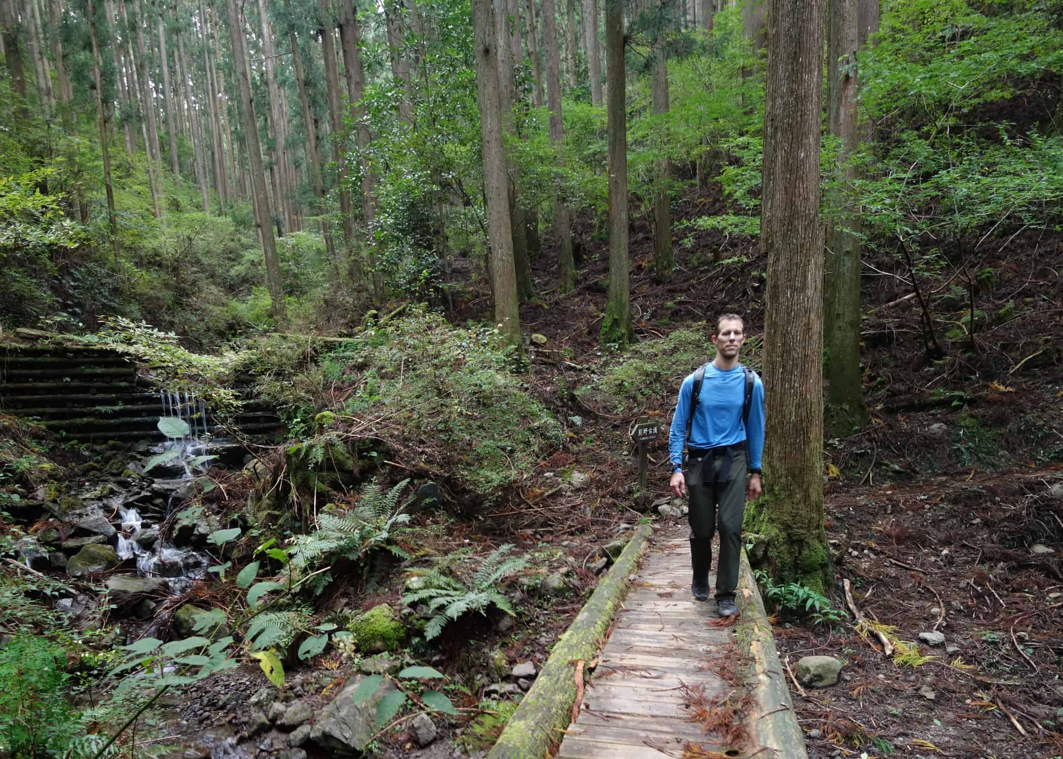
That afternoon was sunny and balmy and nice; great for a hike.
On the Kumano Kodo
Down followed up; oji shrines and remains followed fast, one after the other.
There is a lot of history and spirituality hidden in this seemingly wild landscape…


I reached Chikatsuyu, where many hikers stay for a night, right around dusk.
Everything was still easily visible – which was good, as I had expected to come to Chikatsuyu-oji earlier than I actually did.
A temple bell rang just as I got down there; I did never see where it was, but it made for an interesting entry into this small town. All the more so when music started playing from a public announcement system soon after.
Over the bridge, and then I found myself at Chikatsuyu-oji.

Hadn’t missed it, as I had feared upon hearing the bell.
A Pilgrim’s Progress…
Not that it was impressive.
All the shrines are less than what one might expect from such a deeply spiritual landscape, many shrines and remains are even less than a torii and a shrine structure – and more than meets the eye.
All the places where there are shrines or there are remains and used to be shrines, all the places where kami (gods) are clearly being remembered and cared for, made for an impression of a spirituality that is, at the same time, less important (certainly less eye-catching) than one might have expected, but all the more lived.

Many of the oji shrines, however, were a bit off the main trail, some to the side, some up a short trail or detour, some just weren’t full shrines anymore.
So, however they were, I was always happy to find them, collect another stamp if there was one, and know that I was progressing.

… Through the Night
Progress of this kind became all the more interesting a point, and all the more essential a measure, as I entered the forest at the edge of Chikatsuyu again and had to notice just how dark it had become.

The rest of the pilgrimage would be in the dark, with just the little light that was there naturally or the shine of a headlamp or my keychain flashlight, as needed.

More of this part of the path was on roads, through villages, wondering what inhabitants would make of shadowy me passing by, should they notice.


(Actually, I can only tell of one man who noticed me because he was in front of his house. And that being at a somewhat odd intersection, he just pointed out to me which direction I needed to go 😉 )
Passing shrines and remains, the ruins of a settlement, past a cemetery, on paths along rivers and passages across them in the dark made for a very different feel to it all.


The dark envelops you, hides the path, makes such places appear much more suddenly – and it can comfort, hide, let nothing but the trail be visible, make every step a clear progress on nothing but the path.
The Shugendo approach to experiencing mountains and mystery – through discomfort – became all the more fitting as a drizzle set in just as I got to the detour path where the Nakahechi did not go past Iwogami-oji when I walked it, as there was a crack in the mountain slope there. Rather, one had to take a detour south of the normal path.

Light rain accompanied the rest of the way until I found a spot at small waterfalls where I decided to turn in (to my bivouac) for the night. It was a strange, wet, typical forest ground I slept on, the rush of the water nearby, dark and with the drizzle.
Through the Rain
The next morning – or what I would call morning as it was when I woke up and decided to walk on – the drizzle that had been there the night before, the condensation I thought I had felt on the bivy… it turned out to be outright rain that had moved in during the night.
Sleeping stuff went into the outside pocket of my backpack, away from the rest of my gear, I went into my rain jacket again and back on the path.

Dark, rain, fog…
Interesting conditions to walk.
You would really like to see where the path goes on.
Use a little light, and there is just darkness beyond the reflection in raindrops or fog or both, where the light doesn’t reach.
Turn on a stronger light, you can see rather less from all the glare that gets reflected back at you.
The track also got a bit strange there, as there were parts where the path was wide, but nearly flooded. I was not so sure I was on the right side of the river, judging by the GPS track, but definitely was, going by the path and its markers.

Hosshinmon-oji came rather soon, after only some 50 minutes on the trail. Then Mizunomi-oji.

Finally, Dawn
Around Fushiogami (and Fushiogami-oji), day started to break in the middle of the fog and rain.
Hard to tell, actually, where fog began and rain ended. Was I just in rain clouds, or was much of it only condensation dripping off the trees?
Either way, it was all not very comfortable. And it was quite okay with the gear I had.

With dawn, low as the light was in this – as it turned out to be – next typhoon having moved in, the path presented itself differently again. Clearer to see, but mystical in the fog. If that’s how you want to see it.
In that light, I went on.

Soon enough, only the last few steps remained.


And there was Kumano Hongu Taisha, the end of that subsection.


I got there just as they opened for the day, paid my respects at the shrines, put the stamp that represented the successful completion of a Kumano Kodo pilgrimage into the passbook.
Then I wondered. Should I go on?
Necessary Decisions
I planned to go on initially, had a little online conversation with my wife back in Austria about it all…
Then, just as I wanted to set out for the other part of the Nakahechi, on to Nachi Taisha, the typhoon unleashed such a downpour that I sheltered at a bus stop, checked out the timetable and found that the next bus back to Tanabe would leave in just 10 minutes.
This is a sign, I thought, and headed to Osaka already.
If I couldn’t go on with the spiritual pilgrimage, at least I could continue my quest to “seek spice.“ The pilgrims’ path had already provided me with enough interesting impressions to last, even on that part of it.
Leave a Reply